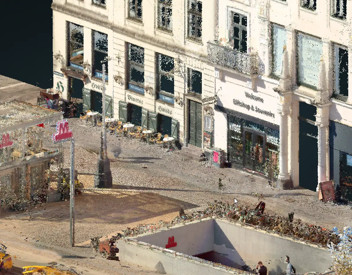
Future M5 stations mapped with 3D technology
Facts: 3D surveys of the M5 stations
When: Spring and summer 2025 Where: From Copenhagen K to Prøvestenen
Objective:
- Reduce nuisance for neighbors and shops.
- Ensure precise planning of design and construction sites.
- Avoiding flooding through rainwater data Technique: Mobile and handheld 3D scanners.
About the M5 line
The M5 metro line will initially consist of five underground stations and one elevated station:
- Copenhagen Central Station (underground)
- v/ Bryggebroen (underground)
- DR Byen (underground)
- v/ Amagerbrogade S (underground)
- Lergravsparken (underground)
- v/ Prags Boulevard East (elevated)
The other three stations, v/ Refshaleøen, v/ Lynetteholm S and v/ Lynetteholm N, which will be built in phase 2 with expected opening in 2045, will be continued above ground to Lynetteholm.
Metroselskabet is building the M5 in two stages, with the first six stations expected to open in 2036 and the second stage with three stations expected to open in 2045.
At Copenhagen H, passengers from the M5 will be able to easily transfer to metro lines M3 and M4, regional, long-distance and S-trains and buses.
At DR Byen, it will be possible to switch between M1 and M5, while at Lergravsparken it will be possible to switch between M2 and M5.
As part of the preparations for the new M5 metro line, Metroselskabet is using 3D technology to study the future station areas. The aim is to create a precise and digital map of the surroundings that can be used to qualify further planning.
"The surveys give us a detailed, digital picture of the conditions above and below ground, even before construction begins. We get a solid foundation for making the right decisions - both when shaping the final design and when planning how the construction sites will be designed and function in practice. This means we can work more efficiently and reduce the inconvenience to neighbors close to the construction site," says Project Director Russell Saltmarsh from Metroselskabet.
Safe stations - also in cloudbursts
The studies are not just about construction techniques and design. The detailed data will also help us understand how rainwater flows and collects - and how to prevent flooding.
"In order to climate-proof the stations effectively, we need to understand exactly how rainwater moves in the local terrain. The detailed 3D data gives us important insights to prevent flooding - not only in the stations, but also in the areas around them. It's about building robust and future-proof from the start," says Russell Saltmarsh.
By mapping slopes, sewer lines and natural depressions, Metroselskabet can precisely identify where water collects - and where extra drainage or protection is needed.
Consulting surveyors LE34 are carrying out the 3D scans, which cover station areas, switching stations and the control and maintenance center.
From Copenhagen City center to Prøvestenen
The surveys take place from central Copenhagen to Kløverparken at Prags Boulevard East and on to Prøvestenen. In some cases also inside buildings - but only with the consent of the owners. DR Byen is the first area to be surveyed with the 3D equipment and work is already underway.
Technology in the cityscape - without registering people
The surveys are carried out with mobile and handheld systems, which means that you can meet LE34 employees in the cityscape with specialized equipment.
It is important to emphasize that the systems only register surroundings - not people - and that all work is done in accordance with applicable data protection regulations.